Field Data Collection forArchaeology & Cultural Resource Management
Specialized forms, compliance workflows, and field tools designed by industry professionals - not a one-size-fits-all app.
Every Tool Your Field Team Needs
AI-enhanced analysis, Bluetooth GNSS, voice transcription, offline maps, and a powerful form builder -shared across every industry edition.
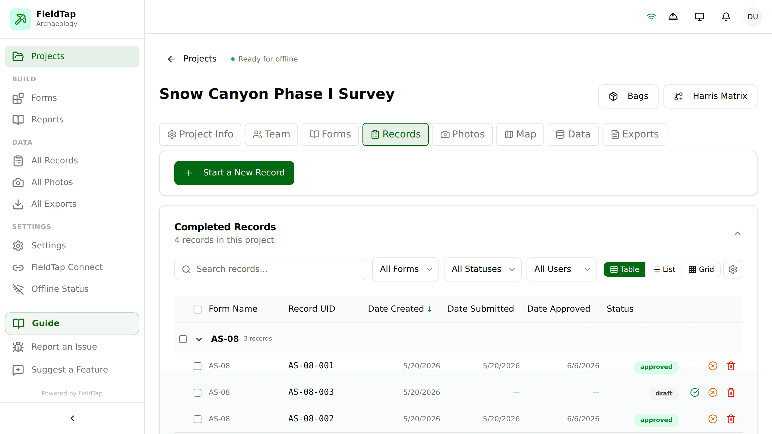
The real thing — live records, review status & one-tap exports
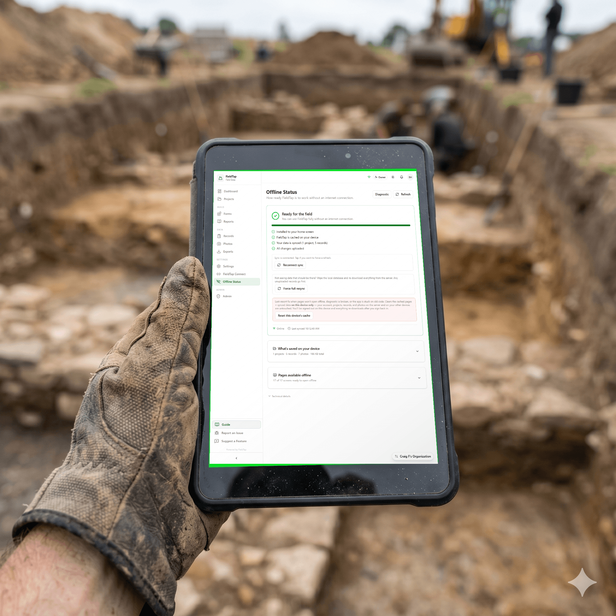
Zero bars, full functionality.
Every form, photo, and map works with no signal at all. Records save to your device instantly and sync themselves the moment you're back in range — no “save again when you have service,” no lost work, no babysitting.
Data Preservation & Security
Encryption at rest and in transit, role-based access, append-only audit trail, and daily encrypted off-site backups. Your field data outlives the project.
Built for the places work actually happens.
FieldTap doesn’t “handle” offline — it assumes it. Every form, photo, and map works with zero bars, every save commits to the device instantly, and the moment you’re back in range it all syncs itself. Your crew never thinks about connectivity, and neither does your data.
Zero bars · zero lost records · zero babysitting
Desktop to dirt — one platform, two modes.
FieldTap isn’t a desktop product with a mobile sidekick. It’s one platform that shape-shifts: the full dashboard for planning and review, and a simplified Field Mode for the crew holding a phone in the rain.
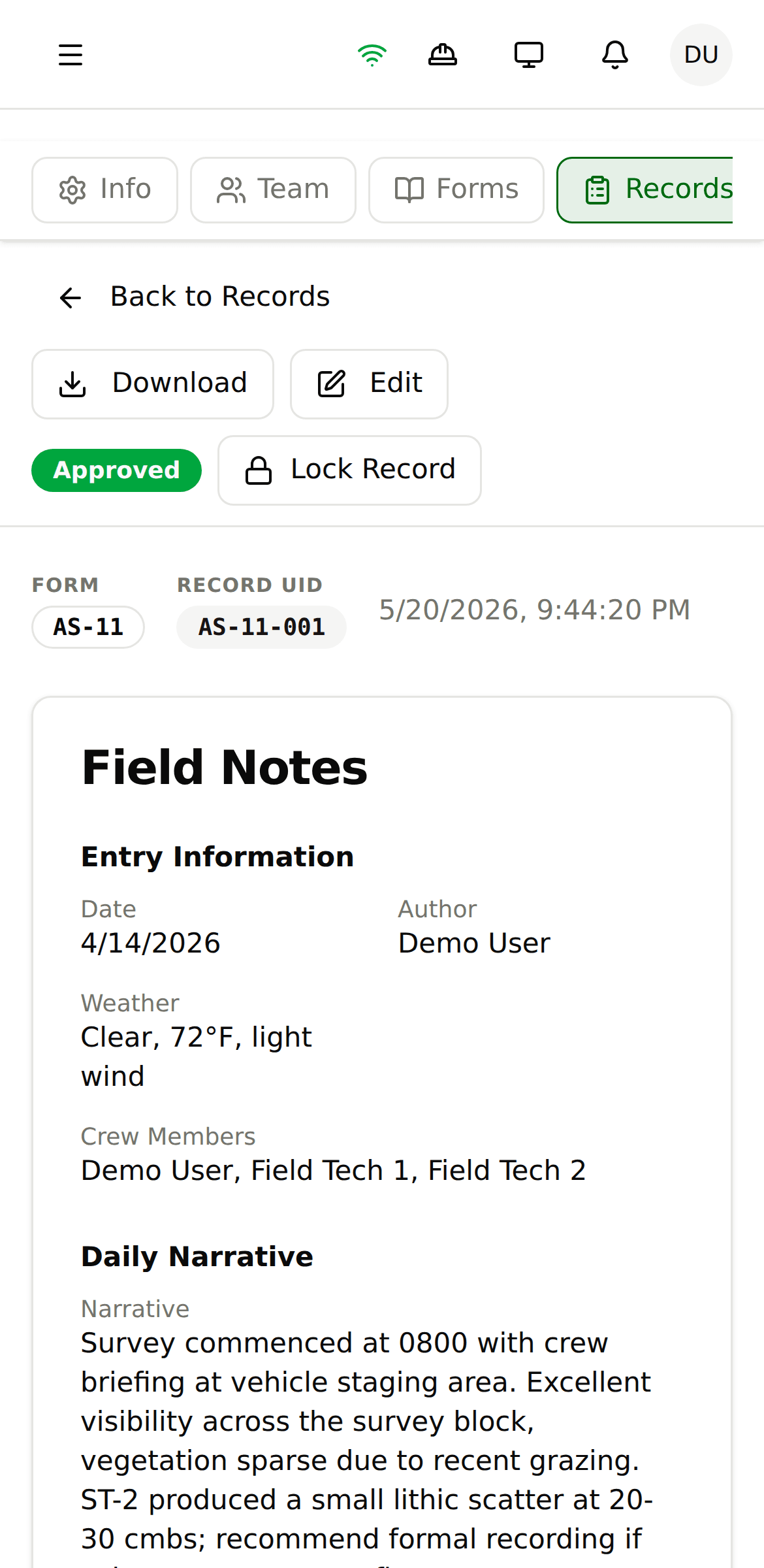
Not a stripped-down companion app — every form, map, photo tool, and export runs on the device in your pocket, online or off.
One tap swaps the manager dashboard for a focused, glove-ready view: the day's project, its forms, and a big Start-a-Record button. Field techs get it by default.
A record captured on a phone in a dead zone is the same record your PM reviews at a desk minutes later. No transfer step, no companion-app sync mystery.
Phone · tablet · desktop — capture anywhere, review everywhere
State-supplied PDF forms — filled automatically.
Upload the agency’s official form (SHPO, OAHP, BLM, USACE, state DOTs). Map your FieldTap fields once. Every record exports as filed-ready paperwork — no copy-paste, no formatting drift, no missed fields.
Map once · file forever · fillable or scanned PDF · agency-compliant
Drop a fillable PDF or a flat scan and watch it work.
Photos that fill out the form.
Snap a photo and AI identifies what it’s looking at — type, material, condition, classification — then proposes values for the matching fields on your form. Review, tap to accept, edit anything it got wrong.
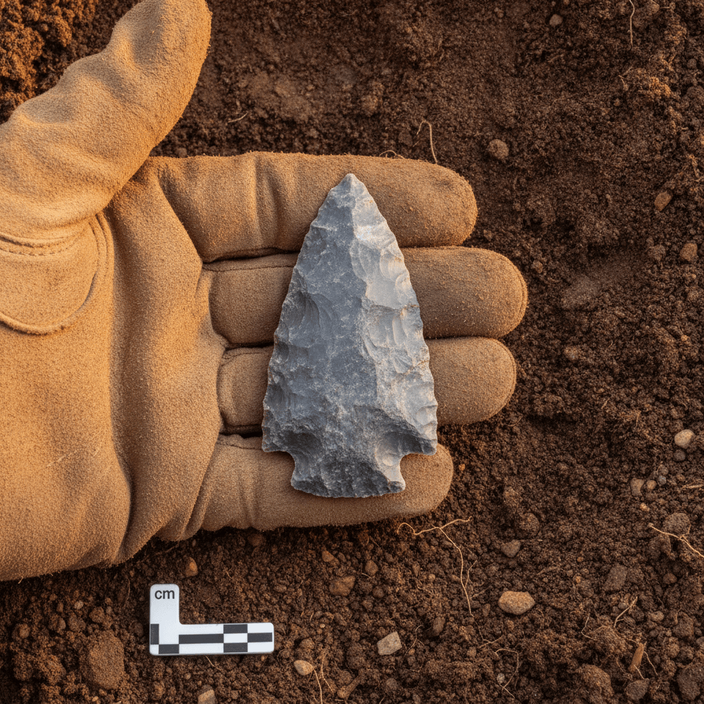
Snap · review · accept — artifact, soil, structure & species aware
Hand off data without handing off files.
Grant another FieldTap organization scoped access to exactly the projects you choose. Prime and sub work the same live records — no exports, no email chains, no version mystery. When the job wraps, revoke access in one click and keep the audit trail.
One project · two orgs · zero email attachments
Simple, Transparent Pricing
Try free for 14 days. No credit card required.
Save 22% with annual billing ($348/yr)
- Up to 20 users
- Offline-first data sync
- Custom form builder + 120+ forms
- Export any format (inc. SHPO)
- Review workflows, roles & GNSS
Save 20% with annual billing ($468/yr)
- Everything in Professional
- Unlimited users
- AI FastFill — photos & voice fill your forms
- FieldTap Report Builder (state PDFs)
- FieldTap Connect + ArcGIS, Drive, Slack
50+ seats? Lock in a custom annual rate and save more than any per-user plan
- Everything in Business
- Custom workflows & features built for your team
- SSO / SAML authentication
- Volume discounts for 50+ users
- White-glove migration & dedicated success manager
- SLA guarantees & unlimited storage
Compare all features
| Feature | Professional | Business | Enterprise |
|---|---|---|---|
| Core platform | |||
| Users | Up to 20 | Unlimited | Unlimited |
| Offline-first data sync | |||
| Unlimited projects & records | |||
| 120+ industry-standard forms | |||
| Advanced custom form builder | |||
| Easy data migration tools | |||
| Export data in any format (inc. SHPO) | |||
| Team management & roles | |||
| Review & approval workflows | |||
| GNSS integration | |||
| Record linking across forms | |||
| Line & polygon geometry capture | |||
| REST API access | |||
| Security & audit logging | |||
| Custom reports & document exports | |||
| AI & automation | |||
| FieldTap Report Builder — fill any state PDF | |||
| AI FastFill — auto-populate forms from photos | |||
| AI FastFill — auto-populate forms by voice | |||
| AI photo analysis & smart annotations | |||
| Voice-to-text transcription | |||
| Integrations & sharing | |||
| FieldTap Connect (inter-org sharing) | |||
| ArcGIS Online integration | |||
| Public data shares (live CSV/GeoJSON URLs) | |||
| Google Drive backup | |||
| Slack notifications | |||
| Webhooks & automation | |||
| Enterprise & support | |||
| Support | Standard | Priority | Dedicated manager |
| Custom workflow & feature development | |||
| Custom integrations with your existing systems | |||
| Custom annual agreements | |||
| Volume discounts for 50+ users | |||
| SSO / SAML authentication | |||
| White-glove data migration | |||
| Custom compliance templates | |||
| SLA guarantees | |||
| Storage | Generous | Generous | Unlimited |
Enterprise Security. Startup Pricing.
Your field data deserves enterprise-grade protection without the enterprise price tag. Security isn't an add-on - it's the architecture.
End-to-End Encryption
AES-256 encryption at rest, TLS 1.3 in transit. Every database query, file upload, and API call is encrypted. Your data is protected everywhere.
Role-Based Access Control
Five user roles (Owner, Admin, Project Manager, Field Director, Field Tech) with granular permissions at organization, project, and record levels.
Immutable Audit Trail
Append-only activity logs that cannot be modified or deleted. Every record creation, edit, approval, and export is tracked with timestamps and user attribution.
No Data Lock-In
Export everything in 10+ standard formats (CSV, Excel, PDF, Word, KML, GeoJSON, Shapefile) anytime. Cancel and take all your data with you.
Row-Level Security
Supabase RLS policies enforce access at the database level - not just the UI. Even direct API access respects your permission boundaries.
SOC 2 Infrastructure
Hosted on Supabase (AWS) with SOC 2 Type II certified infrastructure. Automatic backups, point-in-time recovery, and 99.9% uptime SLA.
Sensitivity Classifications
Four-level data sensitivity system (Public, Restricted, Confidential, Protected). Sensitive records are invisible to unauthorized users at the database level.
Compliance-Ready Exports
Generate regulatory-compliant reports directly from field data. SHPO formats, federal reporting templates, and custom compliance workflows built in.
Field data is irreplaceable. We treat it that way.
A record you save in FieldTap does not get lost — with a signal or without one. Every entry commits to your device first, syncs itself when you reconnect, and lands in encrypted storage with an append-only audit trail and daily off-site backups behind it.
Records commit to on-device storage the instant you tap save. Airplane mode, dead zones, basement crawl spaces — it's already safe.
Back in range, every queued change uploads automatically. Two crew members editing the same record merge cleanly — nothing is silently overwritten.
Encrypted at rest and in transit, row-level access control, append-only audit trail, and daily encrypted backups shipped to a separate cloud account.
Ready to Modernize Your Fieldwork?
Join field teams across 11 industries who collect better data with FieldTap. Try free for 14 days - no credit card required.